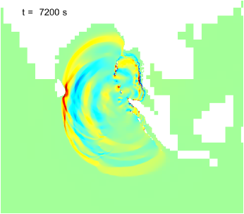
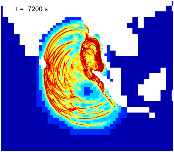
The 2004 Indian Ocean tsunami was caused by a large-scale fault rupture (> 1000 km) at the Indian–Australian and Eurasian–Andaman plate boundaries. This example uses the fault model of Grilli et al. [3] as initial conditions to a Saint-Venant solution of the subsequent tsunami. The evolution of the wave elevation is illustrated in the animation of Figure 48.a. Adaptivity is used to track the various wave fronts (Figure and animation 48.b) and the terrain is reconstructed dynamically based on the ETOPO1 dataset.
(a) (b)
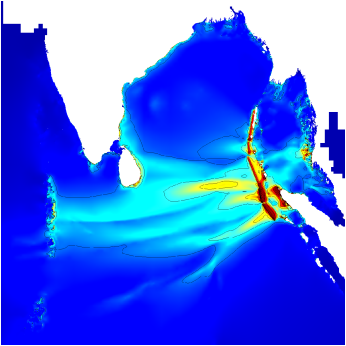
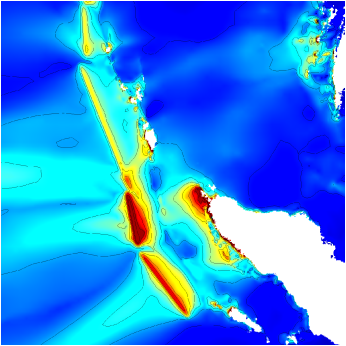
The maximum wave elevation reached over 10 hours after fault rupture is illustrated on Figure 49.
(a) (b)
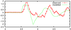
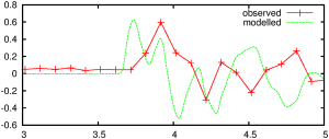
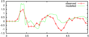
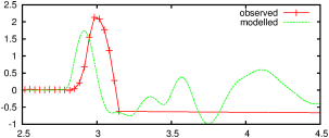
Finally Figure 50 gives a comparison of the observed (using tide gauges) and modelled timeseries at specific locations in the Indian Ocean. Figure 51 gives a comparison of the modelled wave profile with the profile observed by the Jason-1 satellite altimeter.
Figure 50: Observed and modelled time-series of wave elevation (metres) at different tide gauge locations. Horizontal axis is time in hours after the initial fault rupture.
Hannimaadhoo, Maldives Diego Garcia Male, Maldives Columbo, Sri Lanka Gan, Maldives
More details on this simulation and the method used is given in [9].