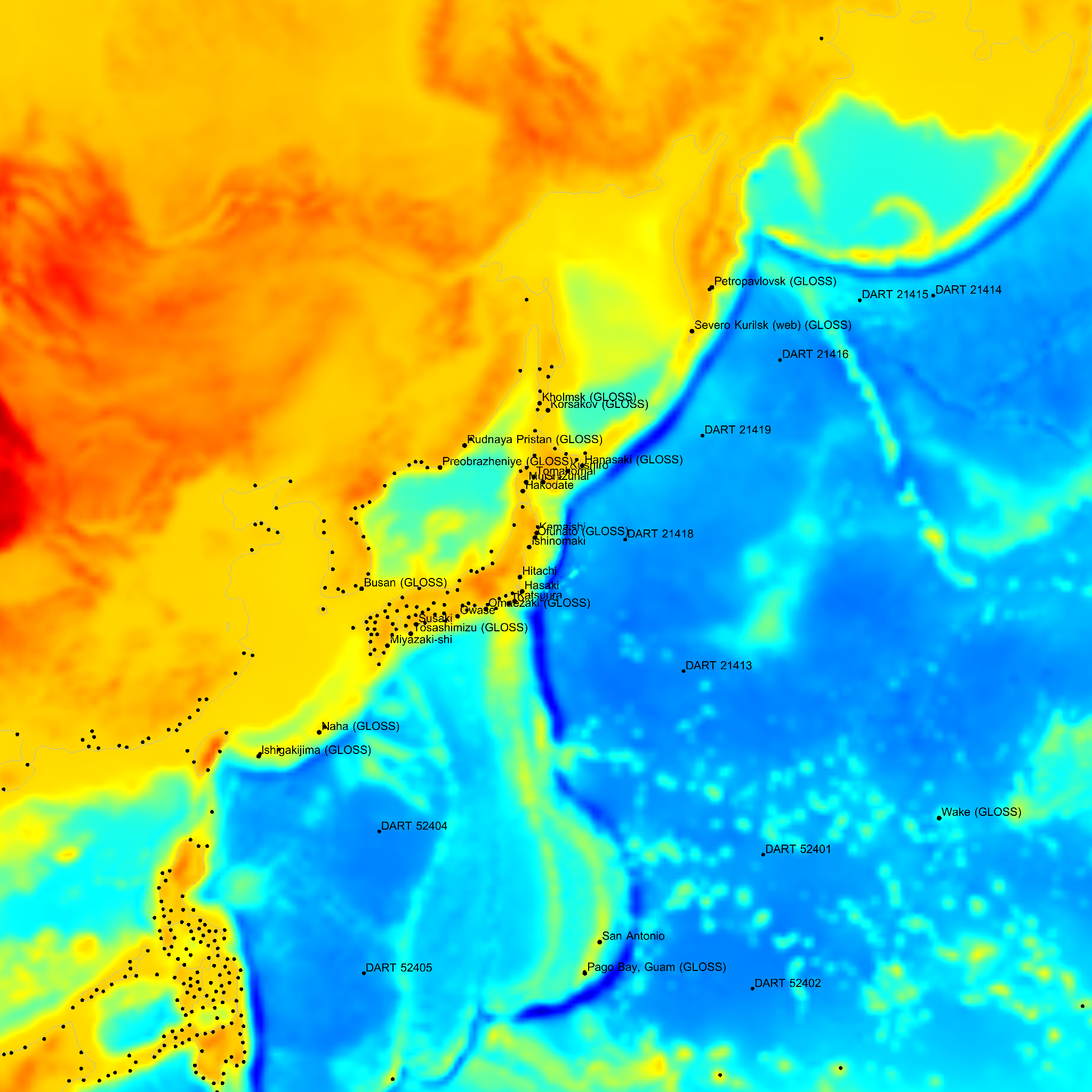
The domain extent is ~8139 km squared.
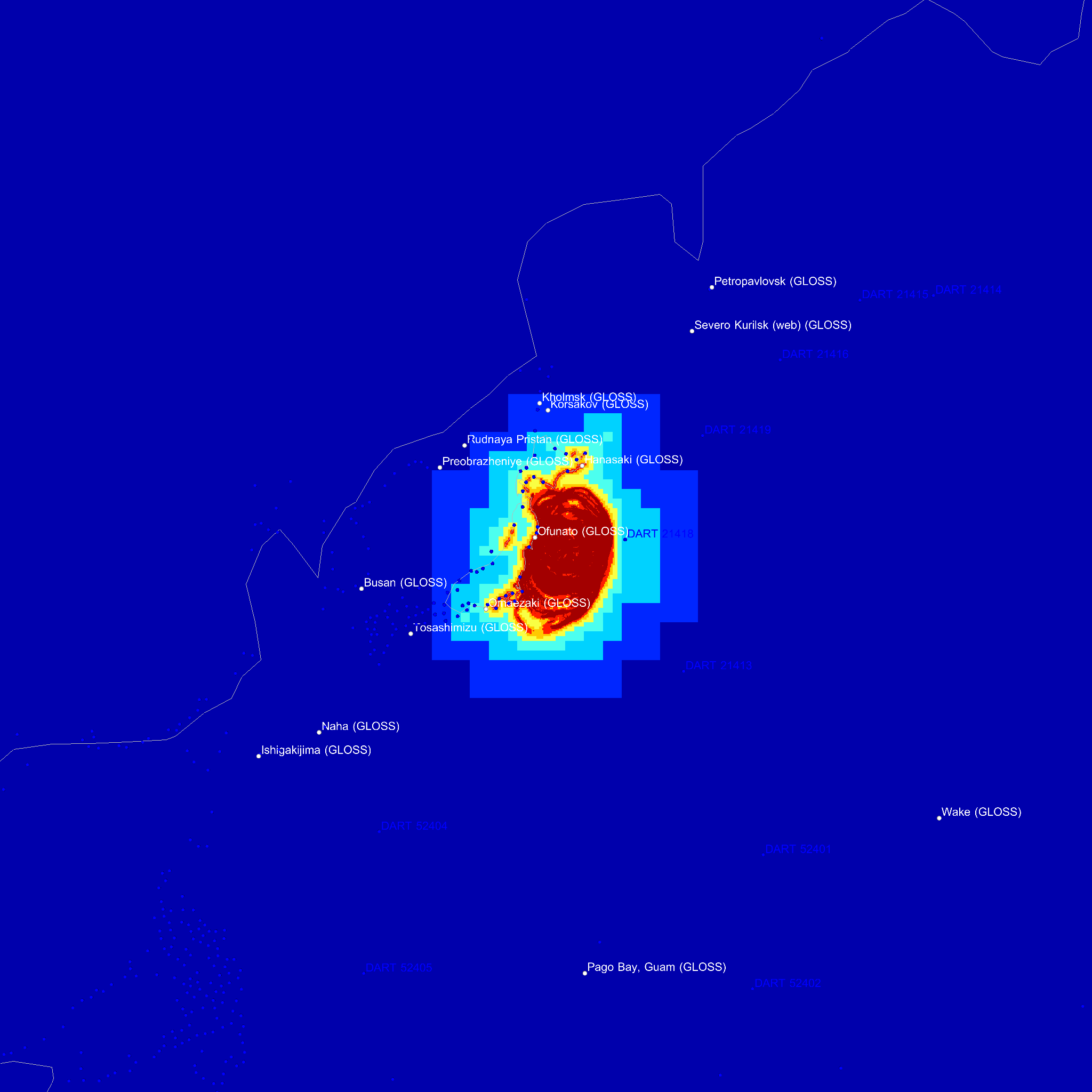
The maximum spatial resolution is 2.0 km and the minimum resolution 254.4 km.
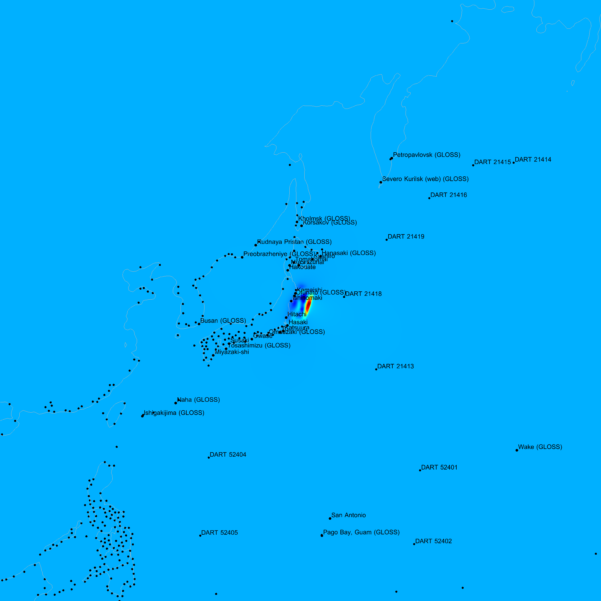
Fault parameters
The results presented on this page were generated automatically using the Saint-Venant solver of Gerris. The source model was reconstructed from the detailed seismic inversion published by Shao, Li and Chi on 16th March 2011.
The scripts used to generate the results presented on this page are available in the Gerris Automated Tsunami Model (GATM) darcs repository.
 |
|
|
Bathymetry and positions of populated places, DART buoys and GLOSS stations. Bathymetry from ETOPO1. The domain extent is ~8139 km squared. The maximum spatial resolution is 2.0 km and the minimum resolution 254.4 km. |
|
 |
 |
|
Initial surface displacement. Fault parameters |
Adaptive mesh at early times. The maximum spatial resolution (dark red) is 2.0 km and the minimum resolution (dark blue) is 254.4 km. |
| Started: | 2011/03/22 11:16:34 UTC |
| Updated: | 2011/03/23 02:19:01 UTC |
| Status: | Completed |
 |
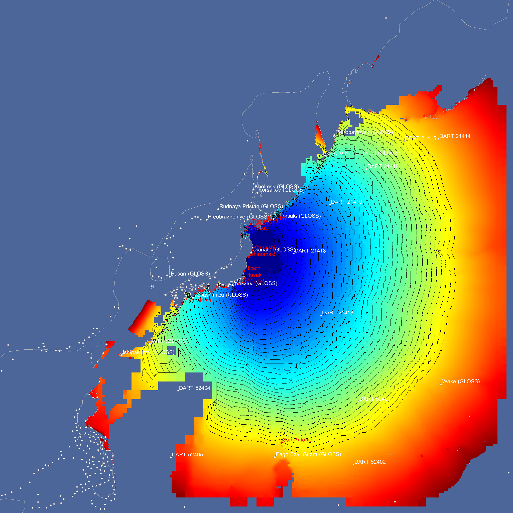 |
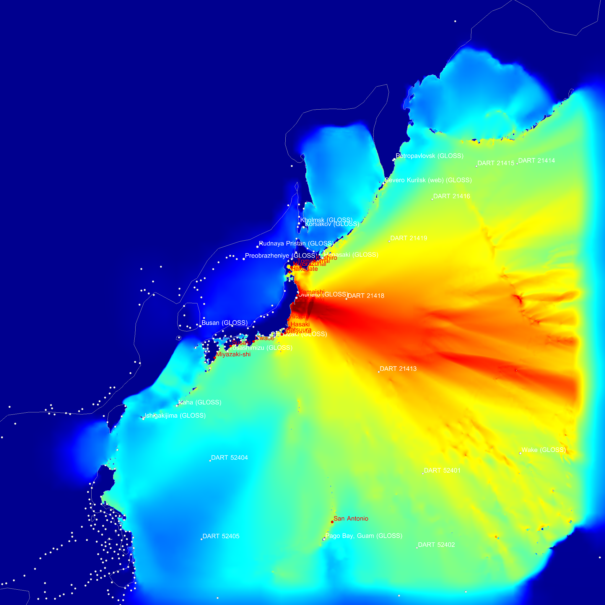
| Maximum wave elevation. | Arrival time of a wave of elevation larger than 10 cm. The isocontours are at intervals of 5 minutes. |
| Name | Country | Population | Maximum elevation (m ASL) | Arrival time (relative) | Arrival time (UTC) |
|---|---|---|---|---|---|
| Kamaishi | JP | 43107 | 24.48 | 34 min | 2011/03/11 06:20:43 |
| Katsuura | JP | 22307 | 1.32 | 47 min | 2011/03/11 06:34:03 |
| Hasaki | JP | 39209 | 3.22 | 50 min | 2011/03/11 06:36:33 |
| Hitachi | JP | 186307 | 5.34 | 51 min | 2011/03/11 06:38:03 |
| Kushiro | JP | 183612 | 1.30 | 58 min | 2011/03/11 06:44:23 |
| Ishinomaki | JP | 117233 | 9.49 | 1 h 2 min | 2011/03/11 06:48:23 |
| Tomakomai | JP | 174806 | 1.55 | 1 h 25 min | 2011/03/11 07:12:13 |
| Shizunai | JP | 22436 | 2.24 | 1 h 40 min | 2011/03/11 07:27:13 |
| Muroran | JP | 96197 | 1.11 | 1 h 55 min | 2011/03/11 07:42:03 |
| Hakodate | JP | 275730 | 1.12 | 2 h 3 min | 2011/03/11 07:49:43 |
| Tateyama | JP | 50064 | 1.44 | 2 h 7 min | 2011/03/11 07:53:33 |
| Owase | JP | 22038 | 1.39 | 2 h 25 min | 2011/03/11 08:12:03 |
| Susaki | JP | 26195 | 1.16 | 3 h 37 min | 2011/03/11 09:24:13 |
| Miyazaki-shi | JP | 311203 | 1.47 | 3 h 38 min | 2011/03/11 09:24:23 |
| San Antonio | MP | 5629 | 1.11 | 3 h 53 min | 2011/03/11 09:39:23 |
 |
 |
 |
 |
 |
 |
 |
 |
 |
 |
 |
 |
 |
 |
 |
 |
 |
 |
 |
 |
 |
 |
 |
 |
 |
 |
 |
 |
 |
 |